 https://www.calbike.org/wp-content/uploads/2026/06/ATPRailHead.jpg
2155
5394
Andrew Wright
https://www.calbike.org/wp-content/uploads/2018/07/calbike-logo.png
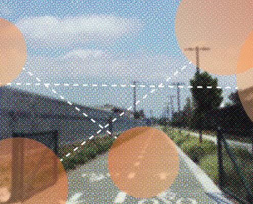
Andrew Wright2026-06-11 12:06:162026-06-11 14:29:47Rail-to-Rail Shows What ATP Can Do
https://www.calbike.org/wp-content/uploads/2026/06/ATPRailHead.jpg
2155
5394
Andrew Wright
https://www.calbike.org/wp-content/uploads/2018/07/calbike-logo.png
Andrew Wright2026-06-11 12:06:162026-06-11 14:29:47Rail-to-Rail Shows What ATP Can Do
Below are links to free maps of bicycle routes on local and regional roadways and state highways, as well as some dedicated bike paths, throughout California.
For more specific route suggestions in your area, contact your local bike advocacy organization. Local cycling clubs are also good sources for touring and recreational routes.
Have an online map to recommend? Found a broken link on this page? Contact us!

Bicycle Tourism
Learn more about how bicycle tourism can enhance your city or region in our report on bicycle tourism in the San Joaquin Valley.

The Latest in Bicycle Advocacy
https://www.calbike.org/wp-content/uploads/2026/06/ATPRailHead.jpg
2155
5394
Andrew Wright
https://www.calbike.org/wp-content/uploads/2018/07/calbike-logo.png
Andrew Wright2026-06-11 12:06:162026-06-11 14:29:47Rail-to-Rail Shows What ATP Can Do https://www.calbike.org/wp-content/uploads/2022/04/Rooftop-reception-Summit-22-scaled.jpg
2560
1708
Kevin Claxton
https://www.calbike.org/wp-content/uploads/2018/07/calbike-logo.png
Kevin Claxton2025-08-28 17:17:282025-08-28 17:24:14California Bicycle Summit 2026 Dates, Location Announced
https://www.calbike.org/wp-content/uploads/2022/04/Rooftop-reception-Summit-22-scaled.jpg
2560
1708
Kevin Claxton
https://www.calbike.org/wp-content/uploads/2018/07/calbike-logo.png
Kevin Claxton2025-08-28 17:17:282025-08-28 17:24:14California Bicycle Summit 2026 Dates, Location Announced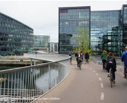 https://www.calbike.org/wp-content/uploads/2025/08/Bike-Highway-Denmark.jpg
414
621
Kendra Ramsey
https://www.calbike.org/wp-content/uploads/2018/07/calbike-logo.png
Kendra Ramsey2025-08-27 18:47:572025-08-27 18:47:59New Directions for Bike Highways
https://www.calbike.org/wp-content/uploads/2025/08/Bike-Highway-Denmark.jpg
414
621
Kendra Ramsey
https://www.calbike.org/wp-content/uploads/2018/07/calbike-logo.png
Kendra Ramsey2025-08-27 18:47:572025-08-27 18:47:59New Directions for Bike Highways